The Great Lake Trail on the on the north shore of Lake Taupo is actually three different trails, two of which start in the small town of Kinloch, the other starting at the Waihaha Hut trailhead on Hwy 32 (Western Bay Road). The trails are open to bikers and hikers, and “share the trail” is the guiding principal.
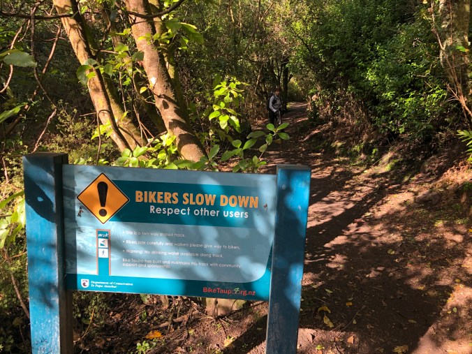
The trails were built by volunteers coordinated by the Bike Taupo group, who have described themselves as “We’re just a bunch of nutters who want to go for a bike ride.” This sign on the W2K (Whaikapo to Kinloch) section of the trail was quite entertaining.

We chose the W2K section of the trail to hike because the Kinloch was just a 30 minute drive from where we were staying in Acacia Bay. We parked in the lot at the marina GPS coordinates (-38.6634123, 175.9200496) and navigated around the marina and through some residential streets to reach one of the trail access points on Boojum Dell road, GPS (-38.6657174, 175.9277707). However, we realized later that we could have also parked on the Kinloch Esplanade road and started the trail at GPS (-38.6680375, 175.9245819), which would have been a tad more convenient but also not as close to grabbing a tasty post-hike latte at the Kinloch Market or the Tipsy Trout Cafe! Another bonus of the marina parking area is getting a pre-hike warmup in the adjacent playground.

The W2K trail has outstanding signage, reminding bikers to be respectful of hikers and making the trail junction choices crystal clear.

The trail elevation changes are gradual and the track is clear and well-maintained. Periodically there are views of the lake, but the bush vegetation can be just as interesting. New Zealand Black Tree Ferns are usually so tall that you don’t have a clear view of the emerging fronds; this one was right by the trail at head height and you could reach out and feel the soft new fronds, which are thicker than your wrist!


We also saw a flowering tree filled with bumblebees! Rosemary heard a noise that sounded like bees, looked up, and was astonished at how many there were. I did some reasearch and found the New Zealand Bumblebee Trust, which informed me that there are four species present in the country, all originally brought from England for the purpose of pollinating the Red Clover crop, grown for use as hay and silage.
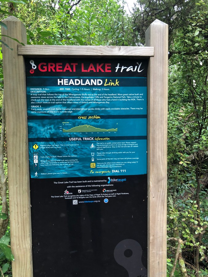
From the start of the trail at Kinloch it is 6km to the junction sign pictured above. From the junction you can do a 9.7km loop out to the headlands, with an optional 2.8km out-and-back to a fine view point. If you carry on to Whaikapo, which is another 8.5km, you will need to either return back to Kinloch or arrange for transportation to pick you up.
We really enjoyed this trail and highly recommend it, except…I suspect in the summer months it will have a lot of bike traffic. The track is only about a meter wide and there are dozens of blind corners. Most bikers are courteous, but some go fast around the corners. Speaking only for myself, I would not be comfortable hiking this trail with a lot of bike traffic; to me it would not be safe. But I’m only speculating; we were there in the middle of winter and saw only four bikers, all of whom were very polite.


Pingback: To Huka Falls and Back to Otumuheke Hot Stream for a Geothermal Soak! | Electric Travels