I chose this hike almost at random from a long list of many possible hikes in the Sedona area. It exceeded my expectations. Here’s how to do it…
To reach Brin Mesa you can start from either the Jim Thompson Trailhead at the end of West Park Ridge Dr or the Soldier Pass Trailhead on Shadow Rock Drive just off Soldier Pass Road (both these trailheads are easy to locate on Google Maps). I chose the latter, but be aware that there are only 14 parking spaces available at the trailhead (I didn’t get one). Many people end up parking on Soldier Pass Road and walking the two-tenths of a mile to the trailhead, since you can’t park on the street in the immediate neighborhood.
It’s worth the walk! The trail leading up to Soldier Pass gradually gains elevation and features numerous streams cutting across the trail, with lovely views of the nearby buttes.


A short but steeper climb brings you to Brin Mesa, offering spectacular views of the surrounding mountains.


Take the Brin Mesa trail southeast (right turn at the top of Soldier Pass). In a few minutes you will see a rock promontory on the right with a use trail leading to it. This is the “Hole in the Sky” viewpoint, and it’s worth the detour!

Continuing on across Brin Mesa there is another worthwhile side trip. When you reach the point where the trail drops off the edge of the mesa, turn left and follow the use trail for about twenty minutes to see a distant view of this waterfall (which in summer likely has no water at all) dropping hundreds of feet down a cliff face.

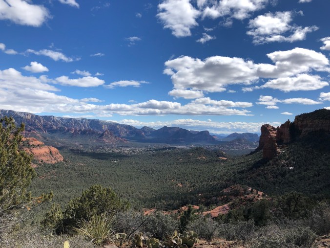
Retracing the path back to Brin Mesa Trail, before descending pause to admire the view.
Continue down to the Jordan Road Trailhead and then take the Anthill Trail to Grand Central Trail which connects to Soldier Pass Trail where you started out. Along the way there are more stunning views of rock spires.


This loop hike totaled out to 8.45 miles and 921 ft of elevation gain.
